Monday, April 14, 2014

Child-Friendly GPS Watch Can Help Keep Kids Safer

Child safety is at the top of the list for parents, school teachers, and others who routinely care for children. But caregivers can’t always have their eyes on the child every moment, and that’s why many have begun relying on GPS tracking devices to help keep tabs on youngsters. However, problems sometimes arise when the child forgets his device or takes it off. That’s why KGPS, a new Israel-based start-up company, has developed a child-friendly GPS tracking watch designed specifically for small children.


children-skiingWhat’s Different About the New Watch?


The HereO GPS Watch has been designed specifically with kids in mind. The band fits better on small wrists and is harder for children to remove, the watch itself is smaller, and the construction and colors were chosen partially based on the input of kids themselves.


Like other GPS tracking devices, the watch can be programmed to send an alert if a child enters or leaves a designated area. It can send periodic location data to parents and can also provide real-time location information.


GPS tracking watches offer an excellent way for parents to keep tabs on their kids when they’re travelling to and from school, spending some time with friends, or going on a field trip. Using the associated app, parents can check up on their kids using their cell phones and can also monitor the location of other family members who have the app installed on their phones.


Features of the HereO GPS Watch


The HereO GPS Watch has many of the same features included with other GPS watches, but it also has a few different twists. Some of the features include:


Child-sized wrist bandDesigned specifically for 3- to 8-year-old children
Basic FeaturesWater-resistant, displays time only
HereO Family  Location AppProvides monitoring capability via cell phone; also links to other family members’ cell phones running the app
Text messaging via appThe app can broadcast text messages to all phones running the app or to individuals
Plot map routesUse the app to determine the best route to meet a person wearing the watch or carrying a cell phone with the app running
Multiple forms of dataView location data periodically or in real time; receive a signal when barriers are crossed
Location historyView several months of location information
Panic alertsTap the watch twice and shake it once in order to send a panic alert
Rechargeable BatteryLasts from 24 to 72 hours per charge

KGPS plans to begin marketing the watch directly to consumers, but will sell it in stores at a later time.


Will It Be Worth the Expense?


The HereO GPS Watch will cost $149.00, including six months of tracking service. GPS tracking devices provide peace of mind for the people who wear them as well as for their family members. It’s impossible to put a price tag on child safety or on the peace of mind a parent could receive from having detailed location data available at all times. Each family must consider how much time the child spends away from the supervision of parents, what the potential risk factors could be, and whether they have the money to invest. Some circumstances might warrant the use of a GPS tracking device more than others, such as:


  • Families in which the child visits another parent in a different home on a regular basis

  • Children who spend a lot of time with a nanny or babysitter

  • Children who ride the bus or walk to school

  • Children who have activities after school when parents are not able to attend

  • Children who take a field trip or overnight trip

  • Family vacations to a busy theme park or other crowded place

What Else Should You Consider?


No one likes to think about the possibility of kidnapping, abduction, or a child simply getting lost, but the truth is that these things do happen. Nationwide, over 2,000 children are reported missing each day. GPS tracking may not be able to keep people with criminal intentions away from your child, but it can help track them down and put them behind bars if something does happen. In addition, if your child becomes lost, GPS tracking can help you find him or her quickly, reducing the amount of stress and anxiety for both you and your child.


A watch may not be the best solution for every child. Some children carry a cell phone, wear a GPS tracking device clipped to a backpack or pocket, or wear some other kind of alert device. All of these can be excellent ways to help keep your children safe. Ultimately, your decision depends on what works best for your family, how much time your child spends away from your supervision, and what specific needs and expectations you have in terms of tools for monitoring the location of your child at any given time.


Child-Friendly GPS Watch Can Help Keep Kids Safer

Wednesday, April 9, 2014

Is Employee Monitoring with GPS Technology Legal?

GPS tracking and navigation devices have become a part of everyday life in the U.S. and many other parts of the developed world. We have GPS on our phones and in our cars as little helpful tools that get us where we need to go, or even keep our loved ones safe. However, the very feature that makes this technology so helpful is also what makes it so potentially creepy. It is quite unnerving to think that someone might be tracking your every movement, especially without your consent.


Supreme Court GPSWe’ve reported on big, landmark cases that called into question under what circumstances the police could use GPS technology to track a suspect. We’ve also reported instances spouses and relatives, or just plain stalkers have used tracking devices to spy on their victims. There are serious privacy concerns to consider when using GPS technology, so where along the ethical line does employee monitoring fall?


Generally speaking, it is legal for employers to monitor employees by tracking company-owned vehicles or smartphones. An employer doesn’t have the right to track employees without them being aware, nor can an employer track employee’s personal vehicles or belongings. To be safe, employers should always check with the local laws and maybe consult a lawyer before implementing a tracking system. This way, you have all your bases covered and you can properly notify employees of the new system.


Recently, a Schindler Elevator Corporation employee in British Columbia challenged the legality of the employer’s GPS monitoring system. British Columbia has strict laws regarding employee privacy under the Personal Information Protection Act (PIPA). The employee felt that the company was violating his privacy rights by monitoring the vehicles of elevator mechanic drivers.


The company challenged the accusation, stating the the tracking system was primarily for business use and perfectly legal under PIPA. They did not collect any personal information, only vehicle information, so personal privacy was never violated. The main argument was that the GPS monitoring system provided legitimate benefits to the business, such as more efficient route planning, improved driver safety, and reduced “time theft”.


It was left up to the Privacy Commissioner to determine if the employees’ privacy rights were being violated per PIPA. The Commissioner agreed with the employee’s union that the data being monitored could be considered “personal”, because it could be used to identify an individual driver. However, there was still the question of whether the data being tracked was “employee personal information”. The law states that employee personal information could be collected and used without employee consent if “solely for the purposes reasonably required to establish, manage, or terminate and employee relationship.”


In order to determine if the privacy rights of the Schindler Elevator Corporation employees had been violated, the Privacy Commissioner had to consider the following questions:


supreme courtQ: Is the information collected of a sensitive nature? Is more information collected than is reasonably required for the employer’s purposes?
A: The information is not sensitive nor is more collected than necessary for legitimate business purposes.


Q: Is the collection and use of the information likely to be effective in fulfilling the company’s objectives?


A: The employer reported a 30 percent drop in accident costs since implementing the GPS System. This was a good indication the GPS System was effective in promoting safe driving habits. The GPS System was also effective in verifying hours of work.


Q: Are there alternative means to serve the same ends?


A: No. Self-reporting by drivers appeared to be the only alternative to the GPS System and this was not as effective.


Q: Has notice of the purpose of the GPS System been provided to employees?


A: The employees were properly made aware of the operation and purpose of the GPS System.


Based on these criteria, the Privacy Commissioner determined that the company was within its rights to use the GPS technology. Because there were plenty of legitimate business-related benefits to using the technology, and because the employees were properly notified of the monitoring policy, PIPA states that privacy rights were not violated.


The PIPA law is very specific to a British Columbia, so employers in other regions can only use this case as a guideline for best practices. Checking in with a lawyer is always the best way to protect yourself from unknowingly violating employee privacy rights. Whether you’re installing a surveillance system for security purposes, or you want to install a GPS fleet tracking system for your delivery service, knowing the local laws is always your safest bet.


Typically tracking company-owned property will be fair game, as long as employees are notified that their movements are being monitored. There should also be a business-related justification for the tracking, other than keeping tabs on your employee’s whereabouts. However, tracking an employee’s phone or car without them knowing could lead you to a world of legal troubles.


Is Employee Monitoring with GPS Technology Legal?

Tuesday, April 8, 2014

New Wildlife Crimes Unit Fights Poaching in Kenya along with GPS Tracking

Great news for environmentalists and wildlife advocates! It seems that the urgent need to protect Africa’s precious wildlife from poachers and illegal traffickers is being answered. In December of 2013, the Wildlife Conservation and Management bill was passed into law which aimed to enforce stricter enforcement of wildlife protection. On March 5th of this year, the Wildlife Crimes Unit officially started their efforts toward fighting the massive poaching problem in Kenya as part of the new law.


CC Image courtesy of SarahDepper on Flickr


“We are now well-equipped and ready to hit poachers hard,” explained Katto Wambua, new member of the Wildlife Crimes Unit and prosecution counsel in the office of the director of public prosecutions. He added that the unit will be a great asset to the war on poaching. The efforts have been fairly impressive so far. In less than a month, the team has been able to successfully close 26 cases against poachers. 15 of those cases had already been open, but were quickly resolved after being transferred to the KWS special prosecutors. The 26 cases had an impressive 78% conviction rate, especially compared to the police’s 20% conviction rate from January to March 5 when the Wildlife Crimes Unit began working.


The Director of Public Prosecutions, Keriako Tobiko, made a crucial decision to form the Widlife Crimes Unit. The unit aims to send a clear message to poachers, and the entire poaching industry, that wildlife crime will not be accepted in Kenya. “Prosecution will no longer be cited as the weak link in the justice process,” said Wambua. Much of the success of the new law is being credited to more collaboration and communication between KWS and law enforcement. “We regularly hold joint brainstorming sessions and training on the new laws and challenges to map out ways each actor could aid in the delivery of justice.”


The Kenya Wildlife Service (KWS) are doing what they can to protect and monitor the endangered species. “We have 975 wildlife rangers against a demand of more than 2,000 officers,” said KWS Director of Security Julius Kimani. “That is why we want to supplement their effort by deploying drones to survey parks.” Unfortunately, they are still waiting for some of the funding to come in through donations and other sources before they can actually afford to deploy drones. In the meantime, they are using the GPS units and other technology available to them. “We are using aircrafts fitted with surveillance cameras and GPS tracking systems to monitor endangered species,” explained Kimani. “We have also fitted microchips on rhino horns in a bid to monitor their movements.”


CC Image courtesy of sarahemcc on Flickr


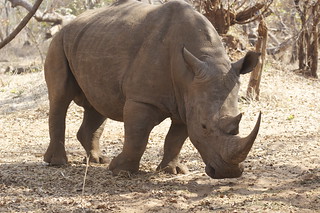
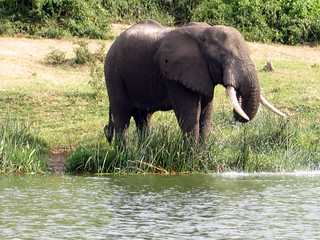
The major targets of the poaching industry are rhinos and elephants, slaughtered for their valuable ivory. It is gruesome and sad to most of us. It’s hard to imagine that such massive beasts as vulnerable. One would like to think an elephant could defend itself, but their dwindling numbers can’t be ignored. Their large size makes them easier to see from a distance, especially with binoculars or from a helicopter or other aircraft. Poachers are using heavy-duty guns to be able to shoot and kill elephants and rhinos from a safe (for the poachers) distance.


What’s more upsetting (to this writer at least) are the people funding and arming the poachers. Poachers often only take the job because there are few other viable opportunities to feed themselves and their families. In fact, a while back there was another effort put forward to deter poaching that worked very well: offer the poachers a job providing security for the wildlife reserves. One great aspect of the Wildlife Crimes Unit, is that it goes after all facets of the poaching industry.


One of the new provisions of the law allow prosecutors to ask magistrates and judges to not let poachers out on bond. “This way, we make sure they are not released and [that they do not] end up tampering with the evidence, intimidate witnesses, abscond from court proceedings or go back to poaching as many did,” Wambua explained.


One investigation officer from the Criminal Investigation Department in Nairobi, David Waweru, noticed a boost in effort towards fighting poachers and ivory traffickers since the Wildlife Crimes Unit was formed. Investigators were encouraged that their efforts would not “gather dust on the shelves of overwhelmed police and KWS prosecutors as it was before.” During the first three months of 2014, a whopping 253 poachers and traffickers have been arrested in Kenya.


“We have actually increased hours of surveillance against organized poaching rings and infiltrated their network,” Waweru said. He credits the improved quality of their investigation has led to much better success rates in persecutions. “I have confidence the combination of thorough detective work and timely, quality prosecutions will discourage would-be poachers through fear of legal punishment.”


New Wildlife Crimes Unit Fights Poaching in Kenya along with GPS Tracking

Monday, March 31, 2014

GPS Trackers for Mallards

Our neighbors to the north have launched a research project to study mallards and other waterfowl during their fall migration. In particular, they are trying to better understand the habitat needs of mallards, including how the habitats are affected by climate change, wind turbines and other factors.  Like many other wildlife research projects, the team will use GPS technology to their advantage. They hope to fit 40 ducks with GPS collars over the three-year research period, but so far can only afford to track one.


CC Image courtesy of Joanna Lee Osbornon Flickr


The lucky duck is called Rondeau Rhonda. It is named after the Rhondeau Bay, which is a popular area for waterfowl. “There is a direct correlation between what goes on at Lake St. Clair and what goes on at Rondeau Bay in terms of waterfowl, where they rest, where they migrate,” explained Mike Moynihan, public relations representative for The Rhondeau Bay Waterfowler’s Association. RBWA donated $1,000 to the mallard research project, allowing them to afford a GPS tracking device. The device provides real-time location data, which will come in especially handy during migration.


GPS tracking is very useful in all sorts of ways. Wildlife research has benefited a great deal from the technology. Typically, when we think of wildlife research, we think of Jane Goodall getting as close as possible to the animals and their natural habitat. In many place around the world, research is still done this way. But for teams fortunate enough to access funding for GPS collars, so much more information is available.


Animals are typically very sensitive to the presence of humans. It’s a survival instinct all of us animals have. When we’re out hiking, if we hear twigs snapping along the trail or otherwise sense we are possibly being followed, our instincts are to escape. At the very least, we aren’t going to be acting naturally. This is the case for many animals in the wild that are threatened by human presence. WIth GPS collars, researchers can monitor the movements of wildlife from a safe, non-invasive distance. Some studies also include motion-detecting cameras to pair with the tracking devices, which provide a more full picture of the habitat. Otherwise, some biologists simply travel to the GPS locations to observe the trails and habitats further.


The GPS tracking data “gives us wonderful data on movement patterns and migration and everything else,” explained Dr. Scott Petrie, Long Point Waterfowl’s executive director, in an interview with The Chatham Daily News. One of the major factors leading up to this research project was the noticeable decline in mallards and their wetland homes in the Lake St. Clair region of Canada. “There’s been a drastic decline in wetland acreage in and around Lake St. Clair,” Petrie said.


CC Image courtesy of uvw916a on Flickr


The study will look at where the mallards are feeding. “We kind of think that bait ponds and flooded corn probably provide important supplemental food for waterfowl.” On the Canadian side of the Great Lakes, Lake St. Clair and Long Point are likely the most significant wetlands. “Lake St. Clair is by far the most threatened, because most of the wetlands at Long Point aren’t drainable… they’re close to wetlands that aren’t dyked,” Petrie said. “Whereas, almost every wetland at Lake St. Clair is diked and very easily drainable.”


Petrie added, “there’s financial incentive for some people to pull the plug, drain their wetlands, then grow vegetables and possibly throw wind turbines in.” Agricultural land in this region is valued from $15,000 to $20,000 per acre. “But, if you put wind turbines into very important waterfowl habitat and the waterfowl avoid those areas, then that’s tantamount to habitat loss,” he said.


The tracking information “is going to have a direct impact on what we’re going to learn about mallard migration and so on,” Moynihan added. “We have noticed over the last few years – this is prior to turbines – that mallards are arriving later and later in the year.” Waterfowl tend to give plenty of space to wind turbines. Observation show that approximately 300 meters around each turbine mallards and other water birds are not found. Meaning, the birds avoid the turbines, likely because of the huge danger their massive blades pose to flying animals. Few, brave birds can be found within a kilometer diameter, called an “avoidance zone”.


“We want to see waterfowl populations flourish and we want to see strong ecology, strong biology and so on,” Moynihan added. Unfortunately, a large factor holding back the research is funding. They have been able to raise enough funds for one GPS tracker, but they hope to raise more money to be able to track a lot more birds. The more birds tracked, the more full, accurate and useful the tracking data will be. If you’re interested in donating to the cause, email spetrie@longpointwaterfowl.org or gdunn@longpointwaterfowl.org.


GPS Trackers for Mallards

Thursday, March 27, 2014

GPS Technology Used to Fight Devastating Poaching Problem

We’ve published many stories here about how GPS tracking devices are used in conservation efforts around the world to help protect and study endangered wildlife species. The technology is so versatile, new ways of using it are being discovered and developed all the time. On February 13, 2014, more than 40 world leaders signed their name to a declaration to combat the illegal wildlife trade industry. One of the best ways to do this includes tracking the wildlife with GPS devices.


GPS Protects Rhinos“The decimation of some of the world’s most iconic species through poaching and illegal wildlife crime has reached epidemic levels, particularly in the case of the African elephant. There can be no let-up in effective law enforcement on the ground to protect these species, and satellite tracking technologies are proving to be hugely helpful to wildlife managers monitoring populations,” said Charlie Mayhew MBE, Tusk Trust’s chief executive.


Once a species is declared endangered, it is protected by law. Unfortunately, simply passing a law doesn’t actually effectively stop poaching. A poacher is someone who hunts protected animals for profit. Typically, the poacher will only take a small part of the animal, like the skin of a tiger or the ivory of an elephant or a rhino, leaving the carcass to rot and waste. The skins and ivory were already valuable, due to the difficulty involved in hunting the wild beasts. However, after these animals were declared legally protected, the added risk involved drove the prices way up and into the black market.


The illegal wildlife trade industry generates around $16.7 billion every year, and the problem only seems to be getting worse. Poaching is absolutely decimating the majestic elephants and rhinos in Africa. In only the last two years, 10 percent of the African elephant population were killed for their ivory. Between 2011 and 2012, poaching of rhinos increased a whopping 43 percent. The good news is that world leaders are listening and better methods to protect endangered species are being implemented.


Volunteers and government employees do the best they can to protect elephants and rhinos in their area, but this is a very dangerous job. Due to the high profits made from poaching, people who are watching out for the animals are often caught int he cross fires. Many times the guards are unarmed, so there isn’t much that can be done if they do have the poor fortune to encounter a poacher.


Thankfully, new ways are being developed in order to protect the elephants and other endangered species with as little risk to human life as possible. “Satellites are increasingly becoming a reliable and resilient tool for monitoring and tracking wild animals,” explained Professor Nick Veck of the Satellite Applications Catapult, who’ve been teamed up with the World Wildlife Fund in Africa tracking elephants with GPS technology.


elephants“Recent advances in satellite-based technologies are changing the face of conservation and ecology, from identifying individuals and whole populations of species to monitoring changes in global forests,” Robert Freeman, who heads the indicators and assessments unit at the Institute of Zoology, Zoological Society of London. “Save the Elephant is combining satellite-uplink GPS tracking collars with Google Earth imagery to continually monitor elephant populations in the wild.”


“GPS tracking can follow the movement of any animal fitted with a tracking device – including after its death. Algorithms could be developed whereby park rangers are alerted by computers to suspicious movements recorded on the tracking device,” explained UCL’s Ray Purdy. Visual technology is also being used to monitor the protected animals. In addition to drones, cameras on satellite may soon be able to detect elephants and rhinos on the ground.


Along with GPS tracking of individual animals, they are hoping to spread awareness of the plight of the rhinos and elephants through a social media program called Instant Wild. Motion-activated cameras have been placed in Kenya, Sri Lanka, Namibia, Indonesia, the U.K. and here in the U.S. which capture images of anything moving in front of the camera. The public can access these images on the website or download the app. Under each image, people are asked if they can see an animal in the photo, effectively helping with the conservation and research project.


“Some animals are going to be harder to GPS tag than others,” Purdy added. “New very high resolution (VHR) satellites increasingly allow for visual surveillance, data collection and availability on an unmatched scale. The resolution on some VHR satellites from 2015 is expected to be between 10 and 25 cm, which would be able to see elephants, rhinos and other large endangered species.”


Unfortunately, this technology tends to be very expensive. A lot of it is top of the line and recently developed. For this reason, especially in impoverished regions where some rhinos and/or elephants roam, it was necessary to appeal to the summit of world leaders. If wildlife populations  are slaughtered to extinction simply because the local government couldn’t afford to properly enforce their protection, the whole world suffers a loss.


GPS Technology Used to Fight Devastating Poaching Problem

Tuesday, March 25, 2014

Researchers Use GPS Tracking After Lucky Boom In Snowy Owl Population

Snowy owls are quite majestic birds of prey. They are large in size and their white faces with brown coloring on the body make for a stunning bird watching opportunity. Because these birds prefer arctic conditions, bird enthusiasts in the United States rarely get a chance to spot them. Occasionally, a snowy owl is seen in the most northern states, but they tend to stay in within the Canadian borders. However, towards the end of November last year, there were many more sightings than normal, and much further south than was ever expected. The furthest south a snowy owl was seen this winter was in Florida.


CC Image courtesy of Will Thomas / Forge Mountain Photography on Flickr


David Brinker, a biologist from the Maryland Department of Natural Resources, almost couldn’t believe his eyes when he saw two snowy owls on a small beach in Maryland. “Something huge is going on,” he said to his team. “We won’t see something like this for a long time – probably for the rest of our lifetimes.” This massive boom in population is the biggest recorded on the east coast in around half a century.


“This winter has brought an unexpected invasion from the North, the largest migration of snowy owls observed in decades. The Arctic birds usually winter in Southern Canada, but this year they’ve been spotted as far south as Florida. As NPR’s Adam Cole reports, scientists are taking advantage of this unexpected visit by equipping a few of the owls with GPS tracking devices,” explained David Greene from WGBH News.


The snowy owl population naturally fluctuates from year to year with fairly predictably patterns with peaks every 4 years or so. This massive increase in owls can be traced to a recent over population of lemurs. Lemurs are rat-like mammals that are a favorite prey of arctic snowy owls. The abundance of lemurs essentially carpeted the canadian tundra. The owls killed way more than they could eat, and actually created nests out of the uneaten carcasses. With an abundance of food, the snowy owls thrived and laid nearly double their normal number of eggs. The baby owls were born with plenty to eat and grew into fat, healthy adult owls.


“They will eat pretty much anything they can jam down their throats – ducks, gulls, geese, muskrats, great blue heron,” explained owl expert, Scott Weidensaul. They’re a very big, very strong, very capable predator. On the Delaware coast, they were seen feeding on a dolphin carcass. That’s a new behavior we’re documenting this year.” Researchers jumped at the opportunity to study more of the snowy owls.


CC Image courtesy of Harlequeen on Flickr


“So Brinker and Weidensaul launched Project Snowstorm, their goal was to tag as many owls as possible with GPS transmitters,” Adam Cole reported to WGBH. “By studying the owl’s movements – for example the fact that they hang out at airports, the scientists hope to better understand their behavior and protect them from hazards. In less than two weeks, Project Snowstorm managed to cobble together a national team of volunteers and $20,000 in donations.”


Researchers trapped the owls carefully and took various measurements before attaching a tracking collar. “Then comes the GPS transmitter,” Cole added. “It’s a small light box that fits easily in the palm of your hand and it’s equipped with a solar panel and a chip that can hold five years worth of data. The owl wears it like a backpack with two thin Teflon straps wrapping around her wings. Brinker carefully sews the straps by hand so they fit the owl’s frame and don’t interfere with flight.”


“The owl takes off, gliding out into the dunes. Already her GPS unit is collecting data – longitude, latitude and altitude every half hour, and every three days her transmitter and the transmitters of the other 15 owls tagged so far will connect to a cell phone network and send all their data back to Project Snowstorm,” Cole said.


The GPS tracking devices will record the owls’ flight back north to the arctic and hopefully shed some light into how to best protect them in the coming decades. Climate change is already affecting the Arctic, where snowy owls live most of the year. Finding ways to protect the lemmings, the snowy owl’s primary source of food. In parts of Greenland and Scandinavia the lemming population may already be dropping, according to the Washington Post.


Snowy owls are amazing and beautiful birds of prey. Spotting these gorgeous owls thrills experienced bird watchers and the average Joe alike. Their white feathers, which serve to disguise them in the snowy Arctic, stand out stunningly in most other settings. We can only hope for another boom in the snowy owl population so that us U.S. citizens might have another chance to gaze upon the snowy owls in the wild. However, if another boost like this were to occur, it probably wouldn’t be for another 40 to 50 years.


Researchers Use GPS Tracking After Lucky Boom In Snowy Owl Population

Saturday, March 22, 2014

Where is GPS Navigation Headed?

For a few Christmas seasons in a row, there was one big gift idea—the one that everyone wanted, even though it was very expensive. Its capabilities seemed almost magical; it promised to increase efficiency by large margins for anyone fortunate enough to own it; and it was downright fun to use. It was, of course, the stand-alone GPS navigation device. During the first week of January each year, brand new navigators popped up on the dashboards of cars across the country. Today, however, many of those coveted devices lie unused, perhaps even consigned to the glove compartment. Is the stand-alone GPS navigator already a nostalgic product of the past?


GPS navigation deviceThe Claims Against Stand-Alone


What happened to take the GPS navigation device from its place of honor to the role of a forgotten tool in many cars? GPS technology progressed more quickly than developers anticipated, outgrowing the dedicated navigation device and spilling over into tablet computers and even cell phones. Before long, it just didn’t seem cost-effective to buy a dashboard-mounted device when you could simply download an app for a fraction of the cost. Some investors understandably panicked, claiming that companies like Garmin and TomTom were headed for disaster by relying heavily on stand-alone GPS technology. Those companies have certainly taken a hit from app competition, but they are far from being out of the race. Why?


Not So Fast


Technology moves quickly, but sometimes the human mind tends to jump ahead of even the fast pace of its own innovation. The usefulness of stand-alone navigators has probably not expired, despite the convenience of pulling up a map on a device you already own. Here are some comparisons of the two methods:


Smartphone GPS NavigationStand-Alone GPS Device Navigation
Restricts the use of other smartphone features (such as talking on the phone!)Provides service regardless of other activity
Uses large amounts of battery powerPreserves phone battery life; often draws power from car
Is not conducive to safe driving, due to small screen and handheld natureIs designed to be visible by the driver while also keeping an eye on the road

As you can see, it doesn’t take much time to come up with some good reasons to keep your phone in your pocket and switch on your dashboard GPS unit instead. Some phones do come with clips that allow drivers to attach their phones to the air vents on the dashboard for better map visibility, but the small size of most phones is still an issue.


Safety and Legality


As stand-alone GPS navigation devices exploded in popularity, safety experts quickly grew concerned about the safety issues inherent in blocking a portion of the windshield with a video display. Lawmakers eventually responded by dictating a maximum size for navigators and specifying where on the dashboard they should be mounted to allow the greatest amount of driver visibility.


With these rules in place, the GPS navigator is often actually a safer option than a smartphone with a GPS app. Without a dashboard mount, a handheld smartphone is extremely distracting to a driver, even more so if the app is not voice-activated. In fact, in more and more municipalities across the country, you could be ticketed for using a phone while holding it in your hand, whether you are using an application or simply talking. Residents and visitors in these areas have few legal options for using their smartphones as replacements for stand-alone GPS navigators.


A valid argument from iPhone users is that their phone can give them directions using voice activation, while their stand-alone device may not. With the right dashboard placement, this advantage may actually make the iPhone a safer choice than basic GPS navigators. But more new navigators are including voice activation without raising the cost significantly, and even the ones that do not usually have a touch screen that is easy to use while driving.


A Personal Decision


While it seems that nearly everyone you meet owns an iPhone or Android-enabled smartphone, there are still plenty of people who opt for a basic phone without a 3G or 4G connection, much less a GPS unit. Buying a basic navigator is far more cost-effective than paying a monthly fee on a new smartphone. On the other hand, people who already own a smartphone may see little reason to buy a new device for their car. It is, after all, a highly targeted theft item and may attract unwanted attention to your vehicle.


Each user must make his own decision, but the balance of pros and cons between phone GPS apps and stand-alone devices is likely to remain fairly even for some time. Perhaps the dashboard navigator, forgotten by many as they loaded their new smartphones with helpful apps, is due for a comeback this Christmas season!


Where is GPS Navigation Headed?